First Orbital Space Launch to make UK History

The first-ever rocket launch from UK soil will take place tonight (Monday 9th January) from Spaceport Cornwall, at Cornwall Airport Newquay.

Using a two-stage-to-orbit air launch, Virgin Orbit’s modified 747 jumbo jet – Cosmic Girl – will take off with the LauncherOne rocket attached beneath its wing.

Marking the beginning of the UK’s future strategy for space, this launch is part of the Start Me Up mission – the first launch of Virgin Orbit’s LauncherOne rocket outside of the USA.

The rocket will be released at 35,000ft over the Atlantic Ocean, where the first-stage engine will fire to start the ascent to orbit.

In total, nine small satellites will be placed into orbit at an altitude of 555km, in what is known as a horizontal launch. These satellites will have a variety of civil and defence applications, ranging from ocean monitoring to navigational technology.

“What we’ve seen over the last eight years is this building of excitement towards something very aspirational and different for Cornwall,” said Melissa Thorpe, head of Spaceport Cornwall.

Whilst Josh Western, CEO of Space Forge, said: “For the first time, the UK has all the pieces of the jigsaw to be able to design and develop satellites, launch them from the UK and operate them from the UK.”

Today’s historic mission represents the first commercial launch from western Europe and the first international launch for Virgin Orbit!


Don’t miss this exciting moment for Cornwall and the UK! The Start Me Up mission will be live-streamed on Virgin Orbit’s YouTube channel from 1:15pm PT / 9:15 GMT: Virgin Orbit – YouTube

Photo Credit: Greg Martin / Cornwall Live

Maxar Technologies Acquired by Advent International

Today (December 16th), Maxar Technologies announced it has entered into a definitive merger agreement to be acquired by Advent International. The all-cash transaction values Maxar at an enterprise value of approximately $6.4 billion.

Following the close of the transaction, Maxar will remain a US-controlled and operated company.

“As a private company, Maxar will be able to accelerate investments in next-generation satellite technologies and data insights that are vital to the Company’s government and commercial customers, as well as pursue select, strategic M&A to further enhance the Company’s portfolio of solutions”, Maxar commented in a statement.

“This includes supporting the successful delivery of the new Legion satellite constellation, accelerating the launch of Legion 7 and 8 satellites, and further growing the Earth Intelligence and Space Infrastructure businesses through investments in next-generation capabilities, such as advanced machine learning and 3D mapping.”

With Advent bringing its 35+ year investment track record with significant experience in global security and defense, this transaction will support Maxar to accelerate the development of next-generation satellite technologies and data insights for its customers.

MTG-I1 Satellite Marks New Era of Weather Forecasting

The Meteosat Third Generation-Imager 1 (MTG-I1) is scheduled for launch today, 13th December 2022 at 21:30 CET, from Europe’s Spaceport in French Guiana.

The European Space Agency has confirmed that the Ariane 5 rocket carrying the satellite is “poised patiently on the launch pad while final checks are being carried out”.

“The Meteosat Third Generation satellite system is set to revolutionise weather forecasting in Europe and enable more precise monitoring of our changing atmosphere, land, and oceans”, said Europe’s Meteorological Satellite Agency (EUMETSAT).

ESA Ariane 5 Rocket
ESA Ariane 5 Rocket – Photo: ESA/CNES/Arianespace

MTG will orbit the Earth at an altitude of 36,000km, keeping a constant view over Europe and Africa. For comparison, the International Space Station orbits at an altitude of about 400km.

“The MTG constellation consists of three satellites: two imaging satellites (MTG-I), and one sounding satellite (MTG-S) as the first operational sounding satellite in a geostationary orbit”.

As one of the most complex and innovative meteorological geostationary satellite systems ever built, the two MGT-I satellites will deliver more frequent data by operating in tandem. With one scanning Europe and Africa every 10 minutes (versus 15 minutes currently), and the other providing rapid scanning service (RSS), scanning Europe every 2.5 minutes. This will make weather forecasts even more reliable as high-resolution imagery becomes available more quickly.

Offering 20 years of operational services, this new generation of satellites will have a wide range of uses, helping to protect lives, property, and infrastructure, as well as bringing economic benefits to Europe and Africa. MTG is also the first geostationary weather satellite with the capability to detect lightning data across a broad area over Europe, Africa, and the surrounding waters.

The hyperspectral Infrared Sounder (IRS), Lightning Imager (LI), and Ultraviolet-Visible Near-Infrared (UVN) Spectrometer are world firsts in this orbit.

“The observations that we’ll receive from these satellites will be critical for many applications, including accurate forecasts of severe weather”, said Dr. Tony McNally, Head of Earth System Assimilation at the European Centre for Medium-Range Weather Forecasts.

McNally is eagerly anticipating the data that will come from a brand-new instrument to the Meteosat series of satellites, the Lightning Imager.

“The four cameras on board will collect continuous, near-real-time data about intracloud, cloud-to-cloud, and cloud-to-ground lightning flashes. This information can be used to identify highly unstable and dynamic regions of the atmosphere – again critical for accurate weather forecasts.”

“Meteosat satellites have been the main source of meteorological data for Europe and Africa since 1977”, says EUMETSAT. If successful, the data from these satellites is one of ESA and EUMETSAT’s key contributions to the World Meteorological Organization’s Global Observing System.

Today’s launch marks an exciting new era for meteorology. We can’t wait to see the real-life benefits this innovative satellite brings.

US Space Force Orders 3 GPS Satellites in $744M Contract

On Nov. 29, the United States Space Force (USSF) announced a $744 million contract with Lockheed Martin.

Signed by the US Air Force, yesterday’s order requested three more GPS 3F satellites – space vehicles 18, 19 and 20.

This marks the fourth contact option exercised under a potential $7.2 billion contract. The first was an order for two GPS 3F (space vehicles 11 and 12) in Sept. 2018, valued at $1.3 billion. The second, in Oct. 2022, was a $511 million contract for two satellites (space vehicles 13 and 14). The third was for space vehicles 15, 16 and 17, valued at $737 million.

Out of the 10 GPS 3 models the USSF has purchased, five have been launched so far.

GPS 3F is the latest version of the US satellites designed to provide global positioning, navigation, and timing support to US military and civilian customers. They’re the most powerful GPS satellites ever built for the USSF. The system is equipped with an improved nuclear detection detonation payload, anti-jamming capabilities, a laser retroreflector array, and search and rescue technologies.

Lockheed were previously commissioned to produce 10 GPS 3 satellites in 2008, but have now progressed production to the GPS 3F version.

These new GPS satellites will bring the US’s current constellation of 31 spacecraft into 2022, replacing systems dating back to the 1990s and early 2000s.

These contracts mark an exciting era for the space sector. With each new satellite, the USSF will modernise their GPS constellation to improve accuracy and capability, taking us into the next age of GPS.

NASA’s Orion Breaks Apollo 13 Record

On Saturday, November 26, at 8:40 a.m. EST, NASA revealed that the Orion spacecraft has now travelled the farthest distance from Earth in over 50 years.

This surpasses Apollo 13’s ‘Odyssey’ record in 1970, at 248,655 miles (400,171 km) from Earth.  

Having entered high-altitude orbit around the Moon, and currently cruising at 1,750 miles per hour, today (Nov. 28), Orion will reach its maximum distance from Earth at approximately 272,514.9 miles. 

NASA’s Orion spacecraft, powered by an ESA European Service Module, was successfully launched to the Moon from the Kennedy Space Center in Florida on 16 November 2022.  

As the first major spaceflight of the Artemis program, this mission is testing the Orion spacecraft’s capabilities; the systems, and procedures that would be used for crewed flights.  

 “Following a successful launch on NASA’s Space Launch System rocket, Artemis I is testing the Orion spacecraft on a rigorous mission in the extreme environment of deep space around the Moon”, NASA said. This multistage plan to assess its durability will result in sending astronauts to the moon and beyond in future missions. 

After entering a distant retrograde orbit on Friday, Nov. 25, the US Space Agency stated, “it will take Orion nearly a week to complete half an orbit around the Moon, where it will exit the orbit for the return journey home.” 

If successful, it will allow the Artemis programme to eventually send astronauts on Artemis II in 2024. 

 Although this test flight is uncrewed, it is carrying three suited mannequins, and the European Space Agency’s newest astronaut – Shaun the Sheep, travelling further than any human has before!  

Image: NASA’s Space Launch System (SLS) rocket with the Orion spacecraft aboard

Photo Credit: (NASA/Joel Kowsky)

European Space Agency Secure €16.9 Billion Budget

Josef Aschbacher, the European Space Agency’s Director General, announced a new €16.9 billion budget for the ESA’s activities over the next three years. This is a 17% increase from 2019.

The announcement was made on the second day of the ESA’S Ministerial Council in Paris, alongside French Minister Bruno Le Maire.

Aschbacher’s initial request was for €18 billion, to remedy the Agency’s problems detaching from Russia’s dependency and developing a sovereign launching system. The conference also highlighted the ESA and EU’s commitment to using satellite navigation to bridge the gap between agencies and the private sector.

Contributing members included Germany (€3.5 billion), France (€3.2 billion) and Italy (€3 billion).

In a surprising turn of events, all countries except Italy, France, Poland, the Netherlands, Austria and Sweden lowered their contribution. Italy’s was raised the most, from 15.7% in 2019 to 18.2% this year. New members including Slovakia (€12 million), Latvia (€3 million) and Lithuania (€5 million) bridged the remaining gap in the budget.

One of the biggest boosts in activities was noted in human and robotic exploration (+37% compared to CM19). This confirms the ESA’s mission to continue increasing its presence on the Moon and contributing to the ISS. The Scientific Programme, the ESA’s mandatory solar system project, increased 13% alongside this, with navigation up by almost 5 times. On the flip side, technology dropped by 6.8%.

Looking back over recent progress and onto future projects, we’re excited to see how the ESA will spread this budget to enable exciting new ventures.

NGA DevCorps and Army Cadets Land Navigation Mission

NGA DevCorps took a class in land navigation from Army ROTC cadets earlier this month.

The programme was created by DevCorps Branch Chief Rodney “RJ” Mosquito and conducted by Army ROTC cadets, in coordination with Missouri Army National Guard.

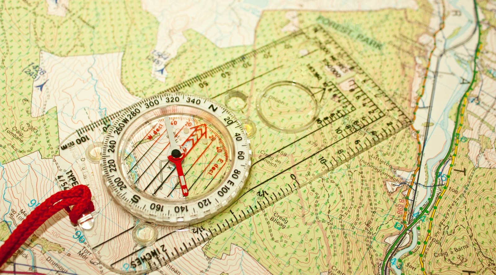
The day started in the classroom, where cadets taught DevCorps members about map reading, using land navigation tools, and pace counting by determining the average step count over 100 metres.

During the lesson, cadets explained that the true nature of land features cannot always be captured on the topographical maps used for land navigation.

Army Lt. Col. Ray Kuderka, professor of military science for the Gateway Battalion, relayed the story of a Joint Special Operations Command mission in Afghanistan. A high-stakes mission had been planned using the most cutting-edge technologies and best maps available, but had to be aborted because of a harsh landscape that hadn’t been detected.

“This story clearly illustrates why geospatial intel products from DevCorps, and NGA must be timely, relevant and accurate,” said Mosquito.

When school was out, the group piled into three Blackhawks and flew over to complete a mission in Weldon Springs, Missouri. In teams, they put what they had learned into practice as they shot azimuths to their navigation points.

Through the exercise, Mosquito said he was “trying to discover a way for software developers to gain the perspective of our Warfighters by walking a mile in their shoes.”

With his own military experience in mind, Mosquito understood the value of teaching DevCorps software developers to navigate land using a map and compass.

In summary of the day, Mosquito added, “this event continues to demonstrate how the NGA workforce can effectively [work with] local, state, and academic institutions, in order to promote teamwork and knowledge transfer in the furtherance of our geospatial mission.”

It’s so encouraging to see three letter government agencies like NGA investing in young people, the future of geospatial intelligence (GEOINT). Not only did this exercise introduce their team to a fresh perspective on land navigation, but the lesson was delivered by skilled young people. With programmes like this in place to inspire the next generation, the GEOINT sector can expand, advance and progress.

EVONA are passionate about cultivating the future of STEM industries. We were thrilled to announce Janna Chapman as the winner of the EVONA Scholarship for Diversity in STEM, in partnership with the United States Geospatial Intelligence Foundation (USGIF). Janna is a talented and driven young person who wants to use GEOINT to address pressing environmental issues. We’re happy to be supporting Janna through her master’s in geospatial science.

It’s great to see our values aligning with an increasing number of agencies like NGA. We hope to see more influential organisations following in their footsteps to ensure a vibrant future for the sector.

British Paralympian Named ESA’s First Disabled Astronaut

John McFall, from Frimley in Surrey, has been selected by the ESA to become the first ever disabled astronaut.  

He will be joining their space training programme, working with engineers and designers in a feasibility study to determine necessary redesigns and adaptations for the mission.

The 41-year-old lost his right leg in a motorcycle accident aged 19, but this didn’t stop him. He went on to compete for Great Britain in the Paralympic Games, and is now making history once again.  

McFall says he hopes to inspire others and highlight that “science is for everyone… and potentially space is for everyone.” 

Over 22,000 people applied to the ESA’s life-changing programme. This is 2.5 times the interest level received in their last competitive process in 2008. 

The ESA revealed its “Class of 2022” today, which includes another six full-time astronauts – among these was British astronomer Rosemary Coogan. Coogan has two master’s degrees from the University of Durham, and a doctorate in astronomy from the University of Sussex. 

UK science minister George Freeman called today a brilliant day for “British science and British values”. He added that he is proud the UK “will be the first country to put a para-astronaut in space and show that space is indeed the new frontier. […] It’s where we destroy the barriers that are holding back this planet and mankind.” 

The ESA intentionally selected candidates with physical difficulties for this project. The agency hopes this will help to build a more sustainable future for disabled people in space.  

This is an enormous milestone in the space sector’s history. While space may have once been for the few, this is becoming ever further from the truth. Concentrated efforts like these are going to blow the sector wide open for a whole new demographic of space lovers, taking them to places many thought they’d never reach.  

We’re wishing McFall and the rest of ESA’s Class of 2022 the best of luck on this adventure of a lifetime. 


Image credit: Jacklee

Humans Will Live on the Moon Within a Decade, Says NASA

In a recent program, NASA officials revealed that humans could well be living and working on the surface of the Moon within the next decade.

This revelation followed the long-awaited launch of NASA’s Artemis 1 spacecraft on Wednesday. The launch was postponed twice in September following Hurricane Ian and a liquid hydrogen leak.

Onboard Artemis was the Orion spacecraft, a key component in the mission to get astronauts back on the Moon. Orion is designed to take humans farther than ever before, serving as the exploration vehicle for deep space. The spacecraft provides emergency abort capabilities, can sustain the crew during space travel, and even provides safe re-entry from deep space return velocities.

On Monday, Orian flew 81 miles above the Moon’s surface at 5,102 mph. Experts are verifying whether the spacecraft will work as planned, allowing them to make adjustments before the Artemis II mission, scheduled to launch circa 2024. If all goes smoothly, Orion, along with a SpaceX vehicle, will land astronauts on the Moon’s surface.

“The mission continues to proceed as we had planned, and the ground systems, our operations teams, and the Orion spacecraft continue to exceed expectations, and we continue to learn along the way about this new, deep-space spacecraft,” said Mike Sarafin, Artemis I mission manager, in a briefing on Monday at Johnson Space Center.

Howard Hu, head of the Orion programme, told the BBC, “It’s the first step we’re taking to long-term deep-space exploration, for not just the United States but for the world. I think this is a historic day for NASA, but it’s also a historic day for all the people who love human space flight and deep-space exploration.”

“Certainly in this decade, we’re going to have people living [on the Moon],” Hu commented. “The durations, you know, depending on how long we’ll be on the surface. They’ll be living, they’ll have habitats and they’ll have rovers on the ground. … So, not only are we able to work in delivering people to the Moon, getting people down to the surface of the Moon, they still have to have the infrastructure.”

Hu later commented that a big reason for NASA trying to get back on the Moon is to determine whether there is water at its south pole. If present, water could be converted into fuel for spacecraft travelling to Mars.

This exciting insight into humanity’s future in space marks a huge milestone for not only the space sector, but for the entire world.

The last manned mission to the Moon was Apollo 17 in December 1972. Five decades on, we’re actually seeing the implementation of systems that will allow us to stay up there long-term. With the industry advancing so rapidly and making such huge strides, we can’t wait to see where the next decade takes us.  

Apple Launches iPhone Emergency SOS Via Satellite

Apple has launched a new space-powered emergency service for iPhone users.

Even in remote areas without phone service, users can contact the emergency services by connecting to nearby satellites.

When an emergency call fails, users will have the option to send an ‘Emergency Text via Satellite’. Their phone will then display on-screen prompts and questions like “what’s your emergency?”, to which they can select responses such as “car or vehicle issue” or “sickness or injury”. After this will follow more in-depth questions about their situation, getting them the help they need ASAP. If you’ve set up your medical ID in your iPhone’s health settings, this information will also be available to the emergency services.

To connect to a nearby satellite, your phone will tell you to point it at the sky and guide you towards the closest satellite. You will need a clear view of the sky, free of trees and other obstructions – without this, it could take upwards of 15 seconds to a minute for the text to go through. Due to the speed at which satellites travel, you’ll need to move your phone to stay connected throughout the conversation.

If the emergency services cannot be contacted via text from a location, the message will be redirected to a relay center where Apple-trained specialists will make the call for you.

“Some of the most popular places to travel are off the beaten path and simply lack cellular coverage. With Emergency SOS via satellite, the iPhone 14 lineup provides an indispensable tool that can get users the help they need while they are off the grid,” commented Greg Joswiak, Apple’s senior vice president of worldwide marketing. “Our teams worked tirelessly to tackle a new set of technical challenges to bring this service to life, in addition to building a reliable on-the-ground infrastructure. Emergency SOS via satellite is a breakthrough service available only on the iPhone 14 lineup, and a new innovation that we hope will provide our customers some peace of mind.”

The service is already available for iPhone 14 users in the US and Canada, soon to be extended to the UK, France, Germany and Ireland in December 2022.

Apple has invested $450 million in the vital infrastructure supporting the service, available for the latest iPhone 14 model. A large portion of the funding goes to Globalstar, a Louisiana-based global satellite service.

Emergencies can happen anywhere, any time, with or without phone service. Powered by satellites networks and ground stations, this cutting-edge service is a perfect example of ways the space sector is making the world safer place. Apple’s innovative system will undoubtedly save multiple lives in the coming months and years. Will other companies follow in their footsteps to provide their own version of this service? Watch this space to find out.