Teledyne: The Future of Airborne Mapping

Teledyne Geospatial, a Netherlands-based pinoeer in geospatial technology, has taken the airborne mapping industry to the next level with the release of the Galaxy Onboard solution.

This ground-breaking solution is designed to simplify the process of delivering high-quality processed data in real-time, making airborne mapping more accessible and cost-effective for organizations of all sizes.

The Galaxy Onboard consists of a rugged onboard computer, a state-of-the-art real-time processing engine, and a comprehensive quality control system. This combination streamlines the workflow from data acquisition to data delivery, reducing processing time and eliminating manual errors. With real-time quality control during data acquisition, the Galaxy Onboard ensures the integrity of the data and enables faster turnaround times for projects of all sizes, including wide area programs and engineering-grade applications.

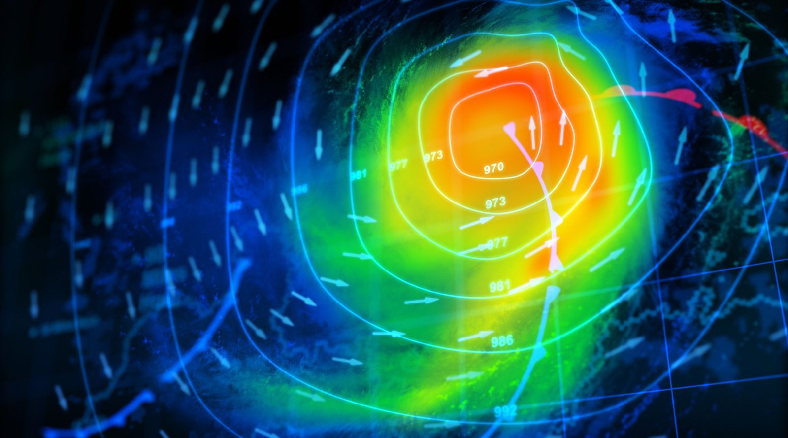
In emergency scenarios, the ability to process 3D data in real-time is critical for recovery, rescue, and restoration efforts. The Galaxy Onboard provides this capability, making the data available while the plane is still in the air. This real-time processing capability is a crucial advantage for organizations involved in life-threatening situations such as hurricanes, storms, power outages, and floods.

Teledyne Geospatial unifies their hardware and software expertise to provide innovative, integrated solutions to their customers. From turnkey systems to lidar and sonar workflows, they offer a range of options that support precision data collection. Their focus on customer satisfaction is evident in the intuitive design of the Galaxy Onboard solution, which provides a seamless and efficient user experience.

In conclusion, the Galaxy Onboard solution is the future of airborne mapping. Its real-time processing, user-friendly design, and exceptional value make it the ideal choice for organizations seeking a reliable and cost-effective solution. With the Galaxy Onboard, Teledyne Geospatial is setting the bar for the airborne mapping industry, making it easier and more accessible for organizations to deliver quality-controlled processed data in real-time.

HERE Technologies and AWS Collaboration

HERE Technologies and Amazon Web Services (AWS) have joined forces to revolutionize the way developers track and manage internet-of-things (IoT) devices.

This collaboration combines the power of HERE‘s location data expertise with AWS‘s cloud computing capabilities, delivering an unparalleled solution for developers worldwide.

HERE Positioning, the location technology at the forefront of this collaboration, is a sophisticated system that relies exclusively on Global Navigation Satellite Systems (GNSS) to provide accurate and reliable location data for a wide range of devices and applications. This technology is now being integrated with the AWS IoT Core Device Location feature, which enables developers to track and manage IoT devices globally, without the need for GNSS/GPS hardware. This integration results in a powerful solution that provides location awareness and high-accuracy positioning, while also ensuring data security for users.

The collaboration between HERE Technologies and AWS takes advantage of HERE’s extensive global database of more than 200 million Cell-ID and 5.6 billion Wi-Fi access point locations. These are continuously updated and populated through advanced machine learning algorithms, providing a comprehensive understanding of the location of IoT devices.

Moreover, this partnership brings together two leading companies in their respective industries, enabling developers to leverage both companies’ expertise and capabilities to create new and innovative solutions. The combination of HERE’s location data and AWS’s cloud computing services opens up new possibilities for developers to track and manage IoT devices in new and exciting ways, such as enhancing the performance of indoor and outdoor positioning capabilities, creating new location-based services, and even tracking devices in areas where GNSS/GPS is not available.

The partnership between HERE Technologies and Amazon Web Services (AWS) represents a significant step forward for the IoT industry, opening new opportunities for developers and users. This collaboration is set to change the way the IoT industry operates and bring innovative solutions to the market.

Remembering Michael Jones — the Creator of Google Earth

Michael Jones, the creator of Google Earth, passed away on January 18th. His passing is a great loss not only for the field of cartography and geospatial intelligence, but for the billions around the world whose lives his genius transformed.

Michael Jones
Copyright © Jarle Naustvik 2011

Michael Jones was a true trailblazer. As the former Chief Technology Advocate at Google, he was responsible for leading the development of one of the most revolutionary and popular mapping platforms of our time: Google Earth. This platform not only made it easier for people to access and explore maps of the world, but it also democratised the field of cartography by making it accessible to people of all backgrounds and skill levels.

“Michael Jones’s work has been nothing short of revolutionary. His ability to blend technology and user-centric approach has redefined the field of cartography, and his contributions will continue to be felt for generations to come,” commented Baroness Lynda Chalker, President of the Royal Geographical Society.

Jones understood that the key to making geography accessible was to create a platform that was not only functional, but also intuitive and engaging. Google Earth was the result of this approach, and it became one of the most widely used mapping platforms in the world, with millions of people using it to explore the world around them.

In 2020, Jones was recognised for his outstanding contributions to the field by being awarded the Society’s Patron’s Gold Medal. This prestigious award is awarded to individuals who have made significant contributions to the field of geospatial information. It is a testament to the impact that Jones had on the field.

“Everyone is inventive,” Jones later commented in an interview. “You need only ignore limits and ask yourself ‘how should it be?’”

“Inventors are just laborers toiling to make things be as we feel they should,” he said. “For me, a key trait is passion for ideas, loving them as parents love children and grandchildren: embracing them, sacrificing for them, excusing the worst and believing the best of them, being patient and supportive with an enduring love as they mature. Like children, they take time to develop into the brightness of their promise. I have been this way all my life.”

Jones’s work has not only made the world more accessible, but it has also changed the way we understand and interact with it. His vision to redefine mapping from static lines and symbols to an interactive geographical web of context and information has left a lasting impact on the field. This innovation will continue to shape the way we understand and interact with the world around us.

Jones’s legacy continues to be an inspiration for those working towards making the world a more accessible and understandable place. His name will go down in history as the man who transformed the map as we knew it, forever.


USA: Home of Geospatial Education

Geospatial intelligence (GEOINT) is a rapidly advancing field offering exciting career paths for those with a passion for mapping, data analysis and problem-solving. The sector is constantly evolving, and with new and advanced technologies on the rise, the possibilities are endless. A geospatial career isn’t just a job, it’s an adventure.

For employers, understanding industry trends is key if you want to get ahead of the competition.  For students, knowing which universities offer the best education for your chosen field of study can be vital to securing the best roles in the industry. According to our data, geospatial organisations seem to sway towards certain universities, but which are they, and why are they preferred?

We looked at hundreds of leading companies in the geospatial sector, including Uber, TomTom, Maxar, Iceye, Satellogic, What3Words,  and which universities their employees attended; and the same names appeared time and time again. Interestingly, over 80% of the graduates that move into geospatial sector come from American universities, and the most popular of these is University of Colorado, Boulder.

Top 10 Universities for Geospatial Studies by Industry Hires:

Heatmap of geospatial universities and organisations
  1. University of Colorado Boulder – USA
  2. Stanford University – USA
  3. The University of California, Berkeley – USA
  4. University of Oxford – UK
  5. Penn State University – USA
  6. George Mason University – USA
  7. University of Arizona – USA
  8. University of Waterloo – Canada
  9. Carnegie Mellon University – USA
  10. University of Washington – USA

All American universities in the top 10 are funded for conceptual space exploration and have close ties with or are funded by NASA.

NASA’s investment in university space programmes is critical for the development and growth of the geospatial sector. By funding research and providing resources for hands-on experience, NASA is nurturing the next generation of talent in the field. These programmes not only prepare students for geospatial and other space-related careers, but inspires them to pursue further innovation and discovery. This support also allows for cross-sector collaboration and problem-solving to improve society.


What makes the USA such a hotbed for geospatial education? 

Out of 114 US universities, the top three in terms of geospatial sector hires are all members of the Universities Space Research Association (USRA). USRA serves as a platform for universities to collaborate effectively with each other, the Government, and other organisations to advance space science, technology, and education.

USRA is dedicated to strengthening the capabilities in environmental data sciences to minimise and remedy real-world problems, such as the effects of natural disasters. The partnership provides access to panels of technical experts from the research community to oversee USRA’s institutes, centres, divisions and programmes.

The eligibility criteria for USRA membership includes demonstrated significant contributions in space or aerospace research fields by faculty, and a substantial commitment to a course of studies and dissertation research leading to the doctorate in one or more related fields.


 PRO CU Campus Aerial; Boulder, Colorado

1. University of Colorado Boulder


File:Stanford University, California (23238123251).jpg

2. Stanford University, California


UC Berkeley Campus - Visit Berkeley

3. The University of California, Berkeley

  • World’s 3rd best college for planetary sciences
  • Ranked #17 out of 2,241 in Best Colleges ranking nationwide
  • Strong connections & partnership with NASA
  • Participated in over 50 space missions
  • Graduated 8th highest number of astronauts of any US college
  • USRA oversight member
  • Total enrolment – 48% male, 51% female
  • Departments – The Rausser College of Natural Resources, Space Science Laboratory, Center for Integrative Planetary Science
  • Courses- Geospatial Information Science and Technology, Earth & Planetary Sciences, Geography, Environmental Science, Policy and Management, Data Science, City Planning, Planetary Science Major

MTG-I1 Satellite Marks New Era of Weather Forecasting

The Meteosat Third Generation-Imager 1 (MTG-I1) is scheduled for launch today, 13th December 2022 at 21:30 CET, from Europe’s Spaceport in French Guiana.

The European Space Agency has confirmed that the Ariane 5 rocket carrying the satellite is “poised patiently on the launch pad while final checks are being carried out”.

“The Meteosat Third Generation satellite system is set to revolutionise weather forecasting in Europe and enable more precise monitoring of our changing atmosphere, land, and oceans”, said Europe’s Meteorological Satellite Agency (EUMETSAT).

ESA Ariane 5 Rocket
ESA Ariane 5 Rocket – Photo: ESA/CNES/Arianespace

MTG will orbit the Earth at an altitude of 36,000km, keeping a constant view over Europe and Africa. For comparison, the International Space Station orbits at an altitude of about 400km.

“The MTG constellation consists of three satellites: two imaging satellites (MTG-I), and one sounding satellite (MTG-S) as the first operational sounding satellite in a geostationary orbit”.

As one of the most complex and innovative meteorological geostationary satellite systems ever built, the two MGT-I satellites will deliver more frequent data by operating in tandem. With one scanning Europe and Africa every 10 minutes (versus 15 minutes currently), and the other providing rapid scanning service (RSS), scanning Europe every 2.5 minutes. This will make weather forecasts even more reliable as high-resolution imagery becomes available more quickly.

Offering 20 years of operational services, this new generation of satellites will have a wide range of uses, helping to protect lives, property, and infrastructure, as well as bringing economic benefits to Europe and Africa. MTG is also the first geostationary weather satellite with the capability to detect lightning data across a broad area over Europe, Africa, and the surrounding waters.

The hyperspectral Infrared Sounder (IRS), Lightning Imager (LI), and Ultraviolet-Visible Near-Infrared (UVN) Spectrometer are world firsts in this orbit.

“The observations that we’ll receive from these satellites will be critical for many applications, including accurate forecasts of severe weather”, said Dr. Tony McNally, Head of Earth System Assimilation at the European Centre for Medium-Range Weather Forecasts.

McNally is eagerly anticipating the data that will come from a brand-new instrument to the Meteosat series of satellites, the Lightning Imager.

“The four cameras on board will collect continuous, near-real-time data about intracloud, cloud-to-cloud, and cloud-to-ground lightning flashes. This information can be used to identify highly unstable and dynamic regions of the atmosphere – again critical for accurate weather forecasts.”

“Meteosat satellites have been the main source of meteorological data for Europe and Africa since 1977”, says EUMETSAT. If successful, the data from these satellites is one of ESA and EUMETSAT’s key contributions to the World Meteorological Organization’s Global Observing System.

Today’s launch marks an exciting new era for meteorology. We can’t wait to see the real-life benefits this innovative satellite brings.

NGA DevCorps and Army Cadets Land Navigation Mission

NGA DevCorps took a class in land navigation from Army ROTC cadets earlier this month.

The programme was created by DevCorps Branch Chief Rodney “RJ” Mosquito and conducted by Army ROTC cadets, in coordination with Missouri Army National Guard.

The day started in the classroom, where cadets taught DevCorps members about map reading, using land navigation tools, and pace counting by determining the average step count over 100 metres.

During the lesson, cadets explained that the true nature of land features cannot always be captured on the topographical maps used for land navigation.

Army Lt. Col. Ray Kuderka, professor of military science for the Gateway Battalion, relayed the story of a Joint Special Operations Command mission in Afghanistan. A high-stakes mission had been planned using the most cutting-edge technologies and best maps available, but had to be aborted because of a harsh landscape that hadn’t been detected.

“This story clearly illustrates why geospatial intel products from DevCorps, and NGA must be timely, relevant and accurate,” said Mosquito.

When school was out, the group piled into three Blackhawks and flew over to complete a mission in Weldon Springs, Missouri. In teams, they put what they had learned into practice as they shot azimuths to their navigation points.

Through the exercise, Mosquito said he was “trying to discover a way for software developers to gain the perspective of our Warfighters by walking a mile in their shoes.”

With his own military experience in mind, Mosquito understood the value of teaching DevCorps software developers to navigate land using a map and compass.

In summary of the day, Mosquito added, “this event continues to demonstrate how the NGA workforce can effectively [work with] local, state, and academic institutions, in order to promote teamwork and knowledge transfer in the furtherance of our geospatial mission.”

It’s so encouraging to see three letter government agencies like NGA investing in young people, the future of geospatial intelligence (GEOINT). Not only did this exercise introduce their team to a fresh perspective on land navigation, but the lesson was delivered by skilled young people. With programmes like this in place to inspire the next generation, the GEOINT sector can expand, advance and progress.

EVONA are passionate about cultivating the future of STEM industries. We were thrilled to announce Janna Chapman as the winner of the EVONA Scholarship for Diversity in STEM, in partnership with the United States Geospatial Intelligence Foundation (USGIF). Janna is a talented and driven young person who wants to use GEOINT to address pressing environmental issues. We’re happy to be supporting Janna through her master’s in geospatial science.

It’s great to see our values aligning with an increasing number of agencies like NGA. We hope to see more influential organisations following in their footsteps to ensure a vibrant future for the sector.

Hurricane Ian – How the Space Sector is Saving Lives

Hurricane Ian has left millions without power, triggered billions in damages and caused at least 81 deaths, with many more reporting loved ones as missing.

After initially making its way through Cuba, the hurricane grew to span practically the entire state of Florida. After being downsized to a tropical storm, it regained hurricane strength and hit South Carolina. Homes, communities and businesses have been devastated by this historic storm.

The category 4 storm was nearly double the size of Hurricane Charley, with 150 mph wind and “biblical” storm surge reaching up to 12 feet. The huge amount of wind, rain and flooding have made this one of the worst hurricanes in Florida’s history. It was described by President Joe Biden as potentially the “deadliest” storm to ever hit the state.

With natural disasters like these on the rise, along with increasing intensity and unpredictability, more focus is moving towards disaster risk reduction and response.

Space technologies play a crucial part in crisis management and disaster response. They enable early warning, prevention and faster response time. The space sector has already proved vital in monitoring and assessing damage caused by Hurricane Ian.

NASA’s weather sensors onboard the International Space Station (ISS), TEMPEST (Temporal Experiment for Storms and Tropical Systems) and COWVR (Compact Ocean Wind Vector Radiometer), provided critical data on the hurricane. While studying the planet’s surface and atmosphere, the systems observed as the storm passed over the Caribbean Sea in low-Earth orbit. Astronauts onboard the ISS took pictures of the hurricane from 400 kilometres above Earth as it approached southern Cuba. The weather sensors streamed this data directly to the NASA Jet Propulsion Laboratory via their Tracking and Data Relay Satellite (TDRS) constellation. The information was with forecasters in under two hours of being collected, enabling early warning and evacuation for those in vulnerable areas.

Satellites also provided valuable data on the storm. Satellite imagery detailed the full extent of the life-threatening storm, allowing experts to track and monitor its path of destruction and create response plans. The National Oceanic and Atmospheric Administration (NOAA) even provided street-by-street satellite maps of affected areas, enabling residents to assess the damage to their homes even if they are inaccessible.

In other news, SpaceX CEO Elon Musk donated 120 Starlink satellites to southwest Florida, restoring internet access to parts of the state hit particularly hard by the storm. It has been reported that over 850,000 people in Florida still have no power.

“We are working with Elon Musk and Starlink satellite,” Florida Governor Ron DeSantis told reporters. “They are positioning those Starlink satellites to provide good coverage in southwest Florida and other affected areas. We are expecting 120 additional large Starlink units to deploy to Southwest Florida.”

In the face of disaster, space-based technologies allow us to stay ahead of the curve and act fast. As the frequency and severity of these natural disasters increases, just as is has done in the face of Hurricane Ian, the space sector’s capabilities will play a vital role in saving lives, minimising damage to affected areas and helping to rebuild communities.

Watch Europe Dry up from Space in this Shocking Timelapse

Satellite images have revealed the shocking impact of droughts across Europe in July and August.

Huge areas of lush green land turned sandy brown as extreme weather conditions savaged the continent.

The European Union’s Copernicus Program captured the mosaic of images through their constellation of Earth-observing Sentinel satellites.

Josef Aschbacher, European Space Agency (ESA) Director General, noted that ESA’s Copernicus Sentinel-3 satellites measured “extreme” land surface temperatures exceeding 45°C in Britain, 50°C in France and 60°C in Spain.

“Today, we are very concerned about the energy crisis, and rightly so. But this crisis is very small compared to the impact of climate change, which is of a much bigger magnitude and really has to be tackled extremely fast,” he commented.

Alongside the timelapse, Copernicus EU tweeted, “In 2022, #drought has affected the whole of Europe.”

Reports have dubbed this drought Europe’s worst in 500 years. The extremely hot and dry conditions increased the risk of forest fires, while water levels in European rivers dropped so low that they were closed to traffic. Water levels dropped to such extremes in Spain that a previously submerged complex of Roman ruins became visible, along with a church submerged underwater by Spanish dictator General Franco. The Global Drought Observatory revealed that 47% of Europe was under drought and weather warnings in August.

Agriculture was hit particularly hard by these historic heatwaves and drought. Lack of precipitation led to widespread stress on crops, particularly across Italy, France, Germany, Portugal, Spain and Hungary.

The space sector – in particular the Geospatial Intelligence (GEOINT) sector – played a vital role in documenting this historic weather and raising awareness of its impact.

Climate monitoring and early warning rely heavily on the space industry. Space-related technologies and information allow us to assess specific areas’ exposure to climate change, adjusting adaptation and mitigation strategies accordingly. Alongside this, Earth observation allows us to predict and monitor natural disasters, as well as gain accurate weather forecasts.

As the climate crisis rages on, the space sector will be instrumental in our shared mission to protect global communities and minimise the impact of climate change.